|
Dunnet -
Within the county of
Caithness there are several interesting areas which are combine a
variety of interesting features and none more so than the Dunnet
Bay area. There are many attractions for the visitor and
some of the more notable are featured here. The quiet roads
and by-ways with single track roads hark back to a much slower
pace of life in rural areas. This peaceful part of Scotland
has much to offer the naturalist, fisherman and anyone looking for
relaxation in unspoilt countryside with a beautiful and rugged
coastline.
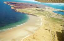
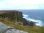
DUNNET HEAD
This most northerly point on mainland Britain rises some
100 metres above sea level. The Dunnet Head lighthouse was
built in 1831 by Robert Stevenson, grandfather of the author
Robert Louis Stevenson. It was automated in 1989. On a
clear day the view point allows the visitor to see as far as Cape
Wrath to the west and enjoy a stunning panoramic view across to John
O'Groats and Duncansby
Head. to the south lies Morven,
the highest mountain in Caithness.
Dunnet Switches On Christmas Lights
- 10 December 2005


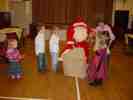 The
Christmas Lights At Dunnet were switched on
this year by Lillian Oag. A smaller than
usual group turned out for the switch on
that has to be set for four o'clock to
coincide with the street lights coming on as
the decorations are attached to the
lampposts. A smaller turnout than
usual was caused by the fact that many
children were attending Christmas Party in
the Viewfirth club in Thurso. The
lights committee at Dunnet have for the past
few years been erecting and maintaining the
lights that now stretch to every lamppost in
the village. Santa was on hand for the
children. The
Christmas Lights At Dunnet were switched on
this year by Lillian Oag. A smaller than
usual group turned out for the switch on
that has to be set for four o'clock to
coincide with the street lights coming on as
the decorations are attached to the
lampposts. A smaller turnout than
usual was caused by the fact that many
children were attending Christmas Party in
the Viewfirth club in Thurso. The
lights committee at Dunnet have for the past
few years been erecting and maintaining the
lights that now stretch to every lamppost in
the village. Santa was on hand for the
children.
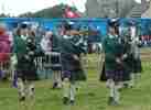
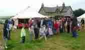
Marymas Fair At Dunnet - Wet Day Did Not Stop The
Fun 27 August 2005

Marymas Fayre 2008
Marymas Fayre 2006
Marymas Fayre 2005
Marymas Fayre 2003
Some Notes On Markets In Caithness In The Old Days - Henrietta Munro
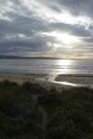
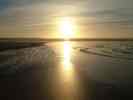
Sunset At Dunnet Beach 30 April
2005
CASTLE OF MEY
Built between 1566 and 1572 by George, the fourth Earl of
Caithness, it became the family home of Sinclair of Mey. In
1789 the elder line of the Mey family became extinct and for a
century it was the seat of the local earldom.
It was in a state of some decay when the Queen Mother bought it in
1952, shortly after the death of King George Vl. The
building was restored and was now the Queen mother's Highland
holiday home until her death. The Castle is open to the
public and can clearly
be seen from a number of vantage points around the Dunnet Bay tour
route. On selected days during the summer the castle gardens
are open to the public. For further details refer to the
local press.
See
Gardens Open to the Public in Caithness
Mey Castle (Barrogil) In ancient Times
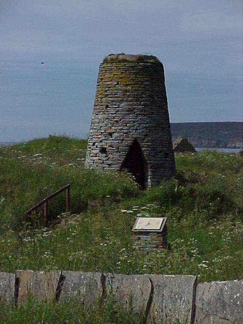
FLAGSTONE
AND HERITAGE TRAIL
Caithness flagstone is known in the building trade
throughout the world. Although the industry went into
decline after the first world war, it is now enjoying something of
a revival.
More
on The Flagstone Heritage.
See entries on the Flagstone
Industry in
Walks
in Caithness
GILLS BAY
Look out across the Pentland firth to the island of Stroma.
Stroma is Caithness's only island and was once home to a community
of crofter-fishers. The population reached 375 in the late
19th Century, but steady emigration thereafter saw the last family
leave for the mainland in 1962.
Stroma takes its name from straum, the Norse for tidal
stream and it is an apt reminder of its location amid the
ferocious currents of the Pentland Firth. During an ebb tide
you will see the tidal race known as Men o' Mey. On the
foreshore is a seal colony. A ferry run by
Pentland
Ferries runs from
Gills Bay in Caithness to St Margaret's hope in Orkney making good
time usually the cheapest car ferry to Orkney.
ROYAL GALLERY
Situated to the west end of the
Castle Arms Hotel in Mey,
just along from the castle, the Royal Gallery offers a unique
photographic insight to the Queen mother's life in Caithness.
Whether attending formal occasions, mixing with locals or meeting
up with other Royals, the relative freedom she has enjoyed in
Caithness is clearly evident.
Open all the year round, entry to the gallery is free and selected
prints are available to purchase.
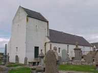
DUNNET KIRK
Dunnet Kirk is one of the oldest religious sites in
Caithness. The earliest references date from 1230 A.D. and,
although the building has been altered a great deal during its
long service, much of the surviving structure still dates from the
16th Century.
Dunnet has been served by many notable men of the cloth.
Prominent among them was Timothy Pont, minister from 1602 to 1610
who was the first person to map much of northern Scotland.
His memorial plaque can be seen inside.
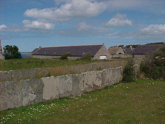
MARY-ANN'S COTTAGE
Situated at the
Dwarwick Pier turning off Mill road,
Westside, Dunnet. This Caithness cottage has hardly altered
since it was built 150 years ago. The Caithness Heritage
Trust has restored Mrs Mary-Ann Calder's former home. This
crofthouse features a wealth of family history. It exhibits
original box-beds and a host of early machines and implements
which were used on the croft. For opening times and entry
fees Tel 01955 603385.
OLRIG KIRK
On the north-west gable of ruined Kirk are date (1633)
and the initials of the then minister David Bruce.
A medieval Kirk probably existed on the site before this date and
may have been dedicated to St Trothan. Despite very strong influence of the Kirk, superstition and
legends abound. The old kirkyard at Olrig is the scene of
the tale about the Selkie Woman. Found as a baby swaddled in
a sealskin, she was subsequently banished from the kirk as a devil
worshipper and ultimately died giving birth to her first child.
A small hollow on the stone reputed to cover her grave is said to
never dry out!
RANGER
CENTRE
Located adjacent to the car park at the north end of
Dunnet Bay (next to the caravan site) the Ranger Centre exhibits
the natural history of the area, including Dunnet Forest.
Dunnet Forest
Leave your car at the
small car park at the Southwest corner of the forest. Follow the
signpost from the A836 roadside. Dunnet Forest lies within
the National Nature Reserve and owned by Scottish National
Heritage. The grassland for which the Reserve has been identified
supports a great number of plant species and range of wildlife.
Some flowers, such as Primula Scotia, and a variety of
butterflies, can be seen within some of the clearings of the
forest. There is a network of
paths through the trees, which provide ideal short and sheltered
walks. This is a good place to go in wet or windy weather. The
ground can be wet in places, but continuing work is being done to
bridge these areas with boardwalks. Dogs are welcome in the forest
as long as they are kept under control. If you are interested
in wildlife and would like to know more, contact the Ranger
Service at Dunnet Bay. The Ranger organises guided walks through
the forest and will point out plants and animals of interest.
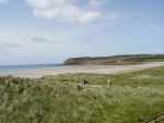
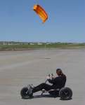
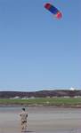
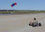
Dunnet Beach
|