| Caithness.Org | Community | Business | Entertainment | Caithness... | Tourist Info | Site Map |
• Advertising • Chat Room • Contact Us • Kids Links • Links • Messageboard • News - Local & Scottish • News - UK & News Links • About / Contact Us • Submissions |
• Bookshop • Business Index & News • Jobs • Property For Sale • Property For Rent • Shop • Sutherland Business Index |
• Fishing • Fun Stuff • George, The Saga • Horses • Local Galas • Music • Pub Guide • Sport Index • What's On In Caithness |
• General Information • B & Bs • Backpackers • Caravan & Camping • Ferries • Getting Here • Holiday Letting • Hotels • Orkney • Pentland Firth • Sutherland • Taxis |
| N E W S F E E D S >>> |
|
Caithness Field Club Bulletin |
|
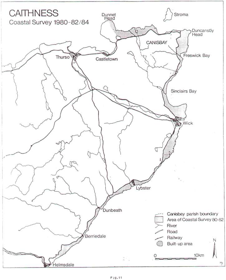
CANISBAY PARISH SURVEY 1984 During the period 1980-82, a coastal survey of the eastern part of Caithness was undertaken by Batey et al1 and a 200% increase on previous known site density was recognised. Part of this survey Included the coastal area of Canisbay Parish. The aim of the 1984 survey was to begin with a detailed examination of the inland area of Canisbay Parish (Fig. 11). The same method of survey was carried out as in previous years, intensive field walking followed by detailed survey plans and plotting of the sites. Some sites were surveyed by the use of a plane table, others, which were less complex, by the use of tapes alone. All sites were photographically recorded. Approximately 35 sites were examined in 1984 in the area immediately to the west of the A9 and south of the A836 on the north coast. Only 6 of these sites had been previously recorded, these included the cairn on Warth Hill and the broch of Stemster which is now very much reduced by the superimposition of a modern silage pit which roughly bisects it. Newly identified sites included indeterminate grass covered mounds and almost completely reduced crofting buildings. However, one site in particular at Tofts, will repay further work, as the mound, which can only be peripherally ploughed, contains very substantial stonework and is very likely to be a cairn. It is hoped to continue this work in 1985. Funding was supplemented in kind by the Royal Commission on Ancient and Historical Monuments of Scotland.
1.
C.E. Batey, Caithness Coastal Survey 1980-82. Dunnet Head
to Ousdale. |