|
ROADS AND TRACKS THROUGH LOCAL HISTORY George Watson
|
|
When this episode is viewed on the
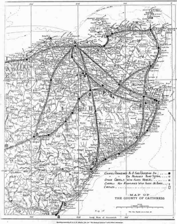
framework of Fig. 17 it can be seen that Glenorchy had been travelling
north from 'e' to 'g'. The crossroad at 'g', just behind the defensive
sweep of the Haster burn was a natural assembly point for local troops
arriving from all parts of the County. This was also the point where it
would become obvious whether Glenorchy intended to attack Wick, via the
Newtown road; or whether he would bypass the town and head straight for
Girnigoe. It would seem that Campbell had been pursuing the latter course
when he was confronted by the enemy in a good position. The road system
shows why the two encounters took place at Stirkoke and Altimarlach which
were close to crossroads 'g' and 'h' . The track 'e' to 'g' was used at a much earlier date, when a combined party of Keiths and Mackays defeated the Gunns in a skirmish on Tannach Moor in 1438 . Further north, still on the same line between 'h' and 'i', In Viking times (c. 980) Two battles are recorded on Skitten Moor. On both occasions, the forces from the south attempted to outflank the defensive line of the Loch and river of Wester, only to find themselves trapped by the soft ground of 'Skida Myre', now the Moss of Wester. Further to the west, on the track between 'i' and 'r' are two significantly named fords; the first 'The Ford of the Meetings' is probably the junction of two of the old tracks, and the second called, 'The Ford of the Roads' carried the combined tracks over the Hobbiegill Burn. The 'oute i, r, q, p, o' can be it illustrated by a story preserved by Thomas Sinclair in his book 'The Gunns' . |
