 | Caithness.Org | Community | Business | Entertainment | Caithness... | Tourist Info | Site Map |
• Advertising • Chat Room • Contact Us • Kids Links • Links • Messageboard • News - Local & Scottish • News - UK & News Links • About / Contact Us • Submissions |
• Bookshop • Business Index & News • Jobs • Property For Sale • Property For Rent • Shop • Sutherland Business Index |
• Fishing • Fun Stuff • George, The Saga • Horses • Local Galas • Music • Pub Guide • Sport Index • What's On In Caithness |
• General Information • B & Bs • Backpackers • Caravan & Camping • Ferries • Getting Here • Holiday Letting • Hotels • Orkney • Pentland Firth • Sutherland • Taxis |
| N E W S F E E D S >>> |
Swartigill Burn
|
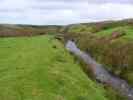
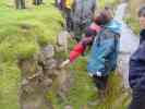
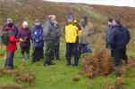
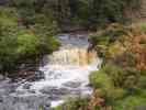
13 October 2002 The short walk following the Swartigill burn took the group who turned out on a fairly breezy and damp day to see a recently discovered Wag, Although it may have been known in earlier times it has not been recorded in any records or on any recent maps that have been studied. The Swartigill burn seems to have been the remnant of a much larger river system which was indicated in river gravels discovered further upstream, and directly below the Mesolithic settlement at Olliclett. the walk began at the world War Two camp just above which runs a "whin dyke" which was often used as a boundary between two farms. Thrumster Estate records mention "toun and lands of Swartigill" as late as 1701, after which, all reference to this ceases. There is evidence of a settlement of some antiquity, and traces of early ploughing and "feal dykes" or turf walls which may have held or sheltered stock. Further up the burn, near a waterfall, there is an old lime quarry. The wag discovered this year which had remained unrecorded until this year has now been scheduled as a National Monument. Across the burn from this is another unrecorded and very large structure which looks to have formed either another settlement or perhaps connected with the wag. No information is available and may not be unless any archaeological dig is ever undertaken. Folk were surprised to learn that such discoveries are still being made right on our own doorstep. On walking back some of the group decided a good name for the wag would be "Swartigill Wag" or "Wag of Swartigill" keeping it located to the local name. |
|
|


